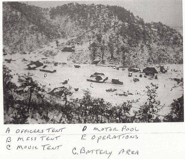
Kumhwa Area Wartime Photos
Mr. Paul Sakrekoff was in counterfire - helping locate enemy artillery by triangulating the sound traveling through the ground. These are some photos taken by him and his comrades during the war. See modern photos for comparison.
Here is his explanation for his unit:
My outfit was the First Field Artillery Observation Battalion, specifically Battery C. ("C" Btry was obligated to cover the IX Corps front and it stretched from 'Chorwon to Kumsong' mostly. "A" Btry had I Corps, and "B" Btry had X Corps.)
Motto - Video et Audio, We See and Hear, a 'Sound and Flash' unit.
WW II and Korea. Our Colors were retired in 1958.
Used BC Scopes on our Flash OP's to locate enemy artillery firing positions
Used surveyed in microphones to hear the sound of the enemy artillery firing and then calculated their location for return missions (fifteen minutes usually with pencil and pre-printed forms). The six microphones of the 'base' were activated by an individual pressing a button on one of our Sound OP's which had to be a minimum of two sound seconds (2,200') in front of the base, for physical reaction time only. The closer the base to the MLR the further forward the OP. Our Kumsong OP was 2000 meters in front of the MLR with a company of Colombians on an outpost hill.
We were not a 'firing' outfit - except for one thirty day period during the push back from the Yalu when we were given 105's and when the line finally held we went back to 'observation' mode.
We also had and used Counter Mortar Radar which was a little iffy in the early days but by the third year was developing pretty well for counter-fire missions.
At one of our reunions a friend, Howard Walrath from "B" Btry in the X Corps, said he got to 'spot' for the USS Missouri firing from off the east coast once. Said he could visually track the rounds from right to left which amazed me no end. I could see rounds from directly behind the gun or a tank firing for a couple of seconds or even the mortar rounds as they slowed at the peak of their arc but the sideways aspect threw me.
Recent Photo Mr. Sakrekoff writes of this 2001
photo, "I took this looking S'ly 'into' our old "C" Btry area from the level
where all the drying chili's were spread during our visit. "Memorial" ridge is
to the left in the pic and Rutkowski's looking down 'labeled' pic was taken from
there. (see below) The 25th was on line when I got there and the 2nd took
over during the winter months and the 7th came on line in the spring and was
still there when I rotated out in June of '52. The 24th and 3rd were to
our left towards Chorwon I seem to remember when I first got there."
The following two photos were also taken by Frank Rutkowski of Delaware, a friend of Mr. Sakrekoff.
Above Shot of area. From the monument ridge looking down on the west side. Nobody was there at the time, not even the burial mounds. All that happened much later."
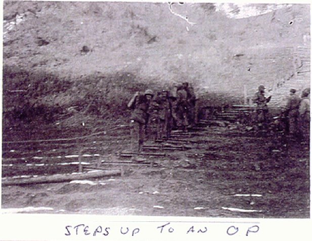
Steps Mr. Sakrekoff says, "Don't know if
the 'steps to OP' was to Flash OP 2 or one of the others. They weren't to
Sound OP 2, I know."
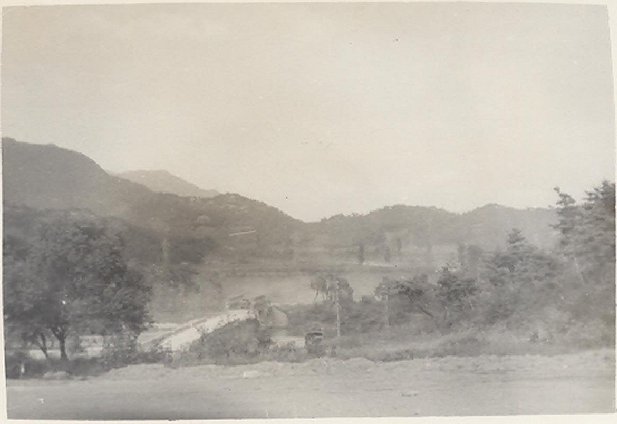
September 1951 Photos
Kumhwa Bridge 2 "The steep ridge going up to the right is the one with the current stairs to the "Memorial", with the trenches and bunkers and the burial mounds at the top. As you can tell the new hamlet of Kumhwa didn't exist on the other end of the bridge in those days."
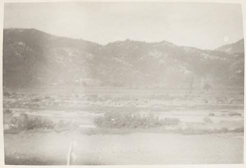
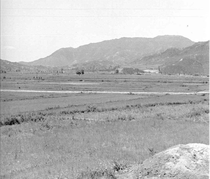
Terrain "Was taken from our "C" Btry area adjacent to "Memorial Ridge" looking N'ly ('out') across the valley towards the ridges behind Boomerang. The MLR at that time was the railroad embankment behind Boomerang and I don't know if we even had any outpost stuff on what came to be known as Boomerang. I do remember one of our guys (Rune from Chicago) being pinned down with a French forward outpost in front of the MLR, possibly towards Boomerang, during an 'incoming' session we had (my group was on the ridge above the French where we got our share) and they kept giving him brandy, cognac and wine from their 'rations' so by the time he got back to us he was feeling no pain. We weren't smart enough to chogie down to the RR embankment to maybe get a share of all the goodies the French had."
Boomerang, Papasan, and OP 2
Mr. Sakrekoff wrote:
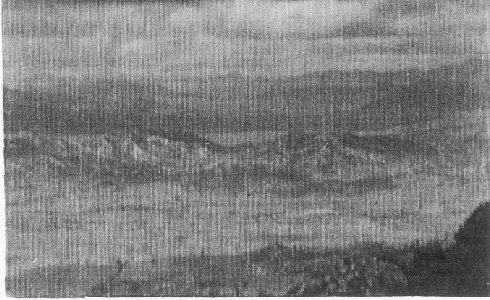
My gut feeling is this could be what came to be called Boomerang, looking down from our Flash OP 2. We had surveyed in Flash OP 2 in late '51 and I'll forward a pic of how elaborate it had become by '53. Someone else from my outfit sent them to me after one of my annual reunions in Fayetteville, NC, but I never pulled time on that OP (I was in Sound Section so served on Sound OP's). The n'ly look at 1062 was taken while we were surveying in a sound base in the valley. Six mic's 1100 feet apart (one sound second) on a given azimuth and two sound seconds in back of the OP for an individuals reaction time to 'push the button' when they heard opposing artillery fire.
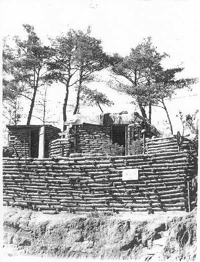
OP 2
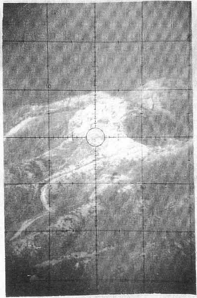
BC Scope at 1062 or Papasan
Mr. Sakrekoff wrote:
As I mentioned the "Boomerang'(?) pic, this OP 2, and one more through the BC scope, were sent to me by one of my reunion buddies. We would have as many as four Flash OP's at a time, with BC scopes, and yes, when they saw the flash of a gun firing they'd call the azimuth in to the forward CP and as they'd been surveyed in the azimuths would be plotted on the acetate covered topos and a three ray intersection warranted calling in a fire mission in return. Sound OP's didn't have to be surveyed in. This pic shows how elaborate these OP's became. They were spotted on high ground, sometimes with the infantry and sometimes behind them, high ground with forward visibility the prerequisite. The Sound OP that I pulled time on had a Flash OP about 15 yards up from us that was just an oversized foxhole with a roof and vision slit for the BC scope and their living bunker was on the reverse side of that crest about 20 ft away. For some strange reason, I never fathomed, our OP was our living bunker, but it was on the forward slope, or 'military crest' I think they called it. OP locations did occasionally fluctuate, why I never knew for sure (I rotated home a corporal-7 mos a PFC and 2 mos a Cpl- so can't say I was privy to many decisions. Just did what I was told and tried to keep my nose clean). The pic through the BC scope I'll send is looking at the W'ly face of 1062. Between looking down at 'Boomerang' and right (E'ly) at 1062 you might be able to figure approximately where the OP was. I'd guess left of the OP Holman had marked on his topo. Looking to the right from Crush Communism towards 1062 I was pretty positive I recognized the ridge we traversed (and caught incoming) above the valley where the French were dug in along the old railway embankment just south of the Boomerang hills. They had outposts at that time towards Boomerang and to the right towards 1062 but the MLR was the railway embankment to my knowledge. My library list has books that talk about this time with some maps that have helped me to understand better now what was going on then. There were three different divisions on line with us while I was there. Directly in front of our battery area that is. We covered IX Corps so there were divisions right and left also as Corps was usually a three division front minimum. I remember being from the Chorwon valley to Kumsong, Hwachon, and tying in with X Corps (where our 'B' Btry was). I Corps was 'A' Btry and HQ Btry, left of Chorwon towards Munsan-ni the 'A' guys told me. By the way, Flash and Sound could call daylight 'sight' missions any time. Being as we weren't a firing outfit, but an Observation Battalion, we could call on Corps artillery, if warranted. I'm rambling, later, Paul
This is view of Papasan from the flat area of the Kumhwa Valley. We believe the hill on the right is the end of the Triangle Hill complex and the hill on the left is the end of Boomerang.