
From OP Crush Communism Toward the Rear Area
Also shown in the previous section, this George McGinn picture is to the right of Papasan and is into the direction of the Triangle Hill Complex, which is probably on the far left. As you look more toward the center and right you can see another ridgeline. This is called Anam-san. During the June 1953 attack on Boomerang, 7th Regt. battalion headquarters and various other formations were in the plain and near the foot of the hills. UN artillery was deployed 4 1/2 to 5 miles behind the hillmass along the Nam Dae Chon River Valley. Before Boomerang was occupied by UN troops, the front line was along a railroad in the valley.
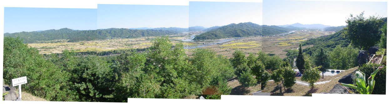
This is looking south from OP Crush Communism toward the rear area where the Nam Dae Chon and Hantan Chon Rivers meet. The river which extends from the left to the right of the picture is the Hantan Chon. Near the center you can see where the Nam Dae Chon meets the Hantan Chon as well as the bridge we crossed to get to the OP. The hillmass on the left side of the picture is Anam-san, behind which the UN artillery was deployed. During at least June 1953 7th Regt. Headquarters, Companies A and B of the Belgian Bn., and medical facilities were there as well.